Weather can be unpredictable at times, causing frustration for those who don’t have the luxury of gazing out their window to make forecasts. Fortunately, advances in technology have made weather forecasting and analysis more accurate and detailed than ever before. Tomorrow.io has recently released the results from its first two radar satellites, which use machine learning to compete with traditional forecasting technologies on Earth and in space.
Originally known as ClimaCell when it was founded in 2021, the company has been planning this mission for some time. Today marks the official release of their findings (soon to be presented at a meteorology conference), proving the success of their innovative approach.
Weather prediction is a complex process, and a major factor in its accuracy is the balance between legacy hardware (such as radar networks and older satellites) and modern software. While these systems are highly capable and valuable, improving their output requires a significant amount of computational effort, with diminishing returns at a certain point.
This goes beyond simply predicting if it will rain in the afternoon, but also includes more critical and intricate forecasts like the path of a tropical storm or the amount of rainfall in a specific region during a storm or drought. As our climate continues to change, these insights are becoming increasingly vital.
The logical solution is to invest in space-based technology, but weather infrastructure is expensive and heavy. For instance, NASA’s Global Precipitation Measurement satellite, launched in 2014, uses both Ka (26-40 GHz) and Ku (12-18 GHz) band radar and weighs over 3,850 kilograms.
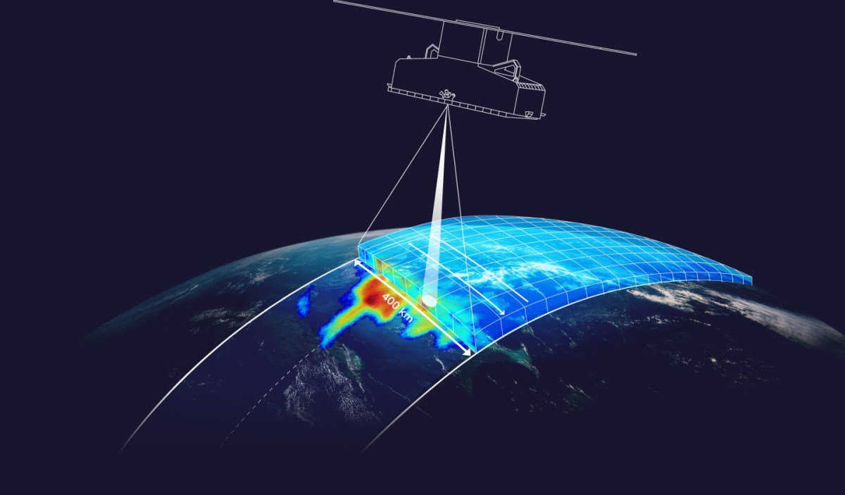
However, Tomorrow.io has a modern twist on the traditional approach, with plans to create a new space-based radar infrastructure. Their satellites are much smaller, weighing only 85 kilograms each, and exclusively using the Ka-band. The first two satellites, Tomorrow R1 and R2, were launched in April and June of last year and have just finished a thorough testing period, revealing their high quality results.
According to Tomorrow’s upcoming journal publication, their satellites were able to achieve similar levels of accuracy or even surpass the GPM and ground-based systems, despite using only one radar band and a fraction of the mass. In various experiments, R1 and R2 provided precise predictions and observations comparable to the GPM, and closely aligned with ground radar data.
These results are possible thanks to the company’s machine learning model, which acts as two instruments in one, as described by Chief Weather Officer Arun Chowla. It was trained on data from both of the GPM’s radars and can make similar predictions by learning the relationship between the observation and the difference between the two radar signals, using just one band. As their blog post explains:
The algorithm is trained with these dual-frequency-derived precipitation profiles but only uses the Ka-band observations as input. Nevertheless, the complex relationship between the reflectivity profile shape and precipitation is “learned” by the algorithm, and the full precipitation profile is retrieved even in cases where the Ka-band reflectivity is completely attenuated by heavy precipitation.
If these results hold true for other weather patterns, it will be a significant success for Tomorrow.io. However, their intention is not to replace the current U.S. infrastructure, as the GPM and ground radar network are vital long-term assets. The real challenge is that these systems cannot be easily replicated to cover the entire globe.
The company’s ultimate goal is to have a network of satellites capable of providing detailed predictions and analysis worldwide. They plan to achieve this by launching eight larger and more advanced production satellites, each weighing around 300 kg.
“We are working towards delivering real-time precipitation data anywhere in the world, which we believe is a game-changer in the field of weather forecasting,” said Chowla. “Our focus is on improving accuracy, global availability, and latency (measured as the time between satellite capture and data availability for product use).”
Tomorrow.io is also preparing for the inevitable data boom, with plans to gather a more detailed set of orbital radar imagery to train their own and other systems. However, this will require a substantial amount of data, and the company plans to accelerate the process by launching more satellites this year.